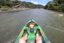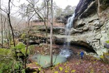


Some float sections get talked about all the time, while others stay under the radar. Floating the Lower Mulberry River is one of those overlooked trips, which is surprising because this is the final major recreational float section of the Mulberry before it hits the Arkansas River. It may not get as many paddlers as the more popular stretches upstream, but it absolutely deserves more attention. Our trip started at Blue Hole on Hurricane Creek and ended at Mulberry River Outdoor Adventures campground (MROA), and from start to finish, it felt scenic, remote, and full of action.
This is also one of the most challenging sections of the river. In fact, it is arguably the toughest float on the Mulberry, with several big rapids that are not for everyone. That is part of what makes it such a great trip for the right paddler. This is not a beginner float, but for people with experience, it offers a fun mix of fast water, technical lines, and beautiful Ozark scenery. If more paddlers are looking for a section that feels a little wilder and less crowded, floating the Lower Mulberry River is well worth adding to the list.
Quick Glance
Hurricane Creek to Mulberry River Outdoor: 9-10 miles
Campbell Cemetery to Mulberry River Outdoor: 16 miles
Coon Hollow to Mulberry River Outdoor: 10-12 miles
Mill Creek to Mulberry River Outdoor: 2-3 miles
Difficulty: Moderate to Difficult
Mulberry River Outdoor Adventure Coordinates : 35.545568, -94.037543
Blue Hole Access Coordinates: 35.61980, -93.96044
Mill Creek Access : 35.569234, -94.020798
Coon Hollow Access : 35.619955, -93.936007
Campbell Cemetery Access : 35.62282, -93.91041
Hurricane Creek/Mulberry Confluence : 35.60986, -93.95142
Big Rapid #1 : 35.60680, -93.95183
Landslide (aka “The Shoe”) : 35.597764, -94.003147
Big Rapid #2 : 35.59726, -94.00766
Big Rapid #3 : 35.58851, -94.01018
Big Rapid #4 (where I flipped) : 35.58222, -94.01261
Switch Back Rapid : 35.552582, -94.035704
(Copy/Paste Coordinates into GPS or Google Maps search bar)
Directions
To get to Mulberry River Outdoor Adventures from I-40, take Exit 24, which is the Main St exit for the town of Mulberry. Go north on Hwy 215 for 1.4 miles. Turn right at the sign for Mulberry River Outdoor Adventures. To get to Blue Hole on Hurricane Creek from MROA, head north again on Hwy 215. Stay on 215 for 11.6 miles, and look for an unnamed gravel road on the right. Coordinates for this Rd are 35.630255, -93.967769. Map yourself to that road first. If you try to the Blue Hole Access coordinates up above, it will take you the wrong way. Once you’ve turned on that road, follow it all the way to the creek. You can use the coordinates for Blue Hole once you get close. For all the other access points, drop the coordinates into your GPS.
What to Expect
Floating the Lower Mulberry River from Hurricane Creek to MROA is about 9 to 10 miles, and it makes for a solid day on the water. This is not a lazy float with long, slow pools where you mostly drift and relax. Instead, the river stays lively with frequent shoals, steady current, and several rapids that require your full attention. Overall, I would rate this float as moderate to difficult, although that can vary some depending on the water level and the paddler’s experience. Even so, this section has a reputation for being one of the most technical floats on the Mulberry.
One of the nice things about this section is that it does not require much paddling. There is plenty of current, a lot of shoals, and enough rapids to keep things moving along at a good pace. So while it is certainly not an easy float, it is also not the kind of trip where you feel like you are grinding away between long flatwater stretches. What it does require is good boat control. You need to read the water well, make quick decisions, and stay alert in the rock gardens and rapids.
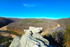
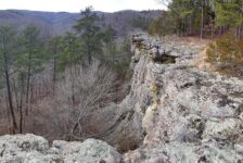
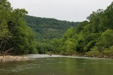
The scenery is also a big part of what makes this float stand out. Rocky banks, bluff-lined stretches, distant mountains, and giant boulders give this section a rugged Ozark feel that is easy to appreciate. It feels more remote than several of the better-known sections upstream, and that adds a lot to the experience. For paddlers who want something scenic, exciting, and a little less crowded, this section has a lot going for it.
Float Details
The float is around 9 to 10 miles total, and we completed it in about five hours without rushing. That included plenty of stops along the way, so it felt like a relaxed pace overall. For the Mulberry River, most paddlers consider 3 feet on the Highway 23 Bridge gauge to be ideal. However, anything above 2 feet should still provide a good float without much, if any, dragging. We did this trip when the water level was 2.4 feet on the Highway 23 Bridge gauge, and that was enough to keep us moving, but it still left a lot of rocks exposed.
For our trip, we started at Blue Hole Access on Hurricane Creek. That lasted about a mile before it emptied into the Mulberry River. Hurricane Creek flows out of Shores Lake, so its level depends on the flow coming out of the lake and is not directly tied to the level of the Mulberry. It was flowing well on our trip, but it was also so rocky that we dragged and got caught on rocks quite a bit. Personally, I probably would not start on Hurricane Creek again unless the water was quite a bit higher. It was still a workable option, but I think this float would be even better if that opening stretch had more water.
Once we reached the Mulberry, the float quickly felt more serious. This might be the most difficult float section on the river in terms of technical rapids. Although it is rated class II, some of the rapids felt borderline class III at this level. At 2.4 feet, there were plenty of exposed rocks to avoid, and even more were hidden just below the surface. Those hidden rocks made several of the rapids feel more precarious than expected. They managed to flip both David and me at different spots during the float.
There are also several places where the river splits, and it is not always obvious which direction to go. These spots are featured in the video further below. For most of the float, going left is the correct choice. However, that changes when you reach Switch Back Rapid. This is the last big rapid in the S-curve near the end of the float. At that point, you will want to stay to the right.
Scenery and Features
This float has a lot of the same look and feel as the Turner Bend to Campbell Cemetery section, although it may feel even a little more remote. I had thought Turner Bend to Campbell Cemetery might be the prettiest section of the Mulberry River, but after doing this one, I am not so sure. This lower stretch is just as pretty. The riverbanks are mostly rocky, a few sections are lined with bluffs, and mountains stay visible in the distance for much of the float. It is not a nonstop bluff float, but the scenery stays consistently interesting. It feels very much in line with what makes the Mulberry such a special river.
One of the biggest visual highlights is the number of huge boulders sitting in the middle of the river. Some are impressive simply because of their size, but one in particular really stands out. This massive boulder has a rope ladder attached so people can climb onto the top. There is even another rope ladder that leads to a second tier. Some people call it “Landslide,” while others know it as “The Shoe.” Either way, it is enormous. It is roughly the size of a two-story house, and it is one of the most memorable landmarks on the float.
That kind of feature gives this section a lot of personality. It is not just a technical whitewater run. It is also a scenic river trip with a rugged, distinctive character that feels a little wilder than some of the better-known stretches upstream. For experienced paddlers, that combination of scenery and action is a big part of the appeal. It is easy to see why more people should consider floating the Lower Mulberry River.


Alternate Float Options
If you want to explore this part of the river but would rather do a different distance, there are a few alternate float options worth considering. Mill Creek to Mulberry River Outdoor Adventures campground is about 2 to 3 miles. It is a short float, but it is known for intense rapids. Because of that, this section tends to attract mostly whitewater paddlers. Some of them will run it several times in a single day. It is a good option for paddlers who want a shorter run with plenty of action.
Another option is Coon Hollow to MROA campground. This float is a little longer than our route from Hurricane Creek. It starts about halfway between Campbell Cemetery and the confluence of Hurricane Creek and the Mulberry River. The biggest advantage is that it lets you skip Hurricane Creek altogether. That may appeal to paddlers who do not want to deal with the rocky and drag-prone start that we experienced. The downside is that the put-in is hard to reach. You really need a Jeep or another 4-wheel-drive vehicle with high ground clearance to access it.
Campbell Cemetery to MROA campground is another option, and that float is about 16 miles long. I was told that overnight floating and camping are allowed on this section, as long as you do not wander too far off the river onto private property. It is also worth remembering that there are some serious rapids on this stretch. So it is not a good idea to be loaded down too heavily with camping gear. Most of the rapids can be portaged if needed, but Switch Back Rapid is not one of them.
I was also told this 16-mile float can be done in one day if the water is high enough. Something around 2.5 feet on the Turner Bend gauge might work, but 3 feet or more would be better. Even then, you would want to start early. I would not attempt it as a one-day float if I were putting on after 10 a.m.
Plan Your Trip
Floating Time: 4-6 hrs depending on flow and number of stops
Cell Service: None up to Landslide. Then good service to MROA (AT&T)
Dogs Allowed: Yes
Closest Outfitters: Turner Bend Store, Byrd’s Adventure Center. But they might not service this section of the river. Call ahead to check.
In my previous articles on the Mulberry, I’ve written about how easily accessible all the put-ins are upstream from Turner Bend are. Well that changes a bit when floating downstream from Turner Bend. Instead of a nice, paved highway, you have to take miles of dirt roads to reach Campbell Cemetery. Shores Lake Rd is gravel all the way, but it’s nice for a gravel road. For the Blue Hole put in, it’s mostly paved. But once you get to the unnamed gravel road, it’s a little rough. 4WD is not necessary, but some ground clearance is helpful. So just be prepared for that.
The best time for floating the Lower Mulberry is typically early Spring through late May. Sometimes we get lucky with good float conditions through mid-June, or a rare heavy rain in late Summer. As with all floats, always check the water levels on American Whitewater or the RiverApp when planning your float on the Mulberry River. The river sections in green or orange on their site are good to go. If you’re still not sure, call Mulberry River Outdoor Adventures to get more info on the river conditions. IMPORTANT NOTE: YOU WILL NEED YOUR OWN VESSEL FOR THIS FLOAT. Mulberry River Outdoor Adventures is not an outfitter. They do not rent kayaks, canoes, or rafts. But they are great folks and can help you navigate the area, and give you float advice. While on the river be sure to leave no trace, and keep this river beautiful.
Accommodations
There are several options for spending the night. Mulberry River Outdoor Adventures campground is really nice. They have RV sites for campers, as well as some campers you can rent. And there are tent camping sites right on the water. They also have “The Loft” for rent, which is right above the campground office. It has a full bathroom, kitchenette, two queen beds, with heat and A/C. The Loft is newly remodeled and trimmed with fresh-cut cedar. It’s really nice. Mulberry River Outdoor Adventure is also a popular spot for ATV riders. So you if have an ATV or side-by-side and love trail riding, this is a great place to stay. If MROA is full, there are cabins for rent in the area. Food options in the immediate area are limited, so bring your own. Otherwise, it’s a 17-minute drive east to Ozark, or a 12-minute drive west to Alma. You can find restaurants in either town, and limited options in the town of Mulberry.
I hope you enjoy your visit to the Lower Mulberry River as much as we did. Enjoy the float!