
#Ozarks
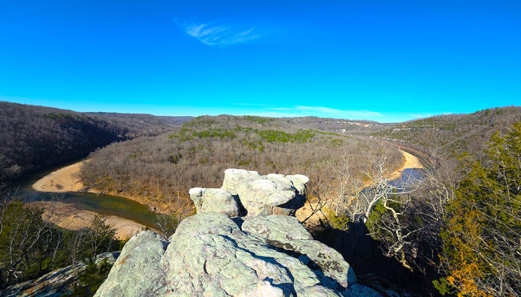

Hike to Devil’s Tea Table in the Lower Buffalo Wilderness
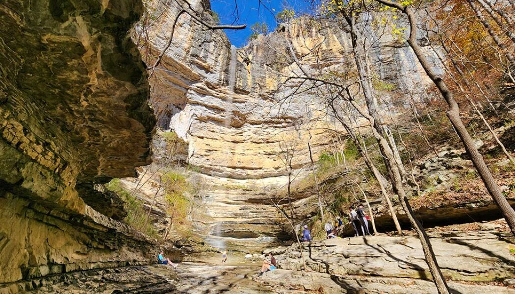
Hiking to Devil’s Tea Table is one of those Buffalo River experiences that quietly surprises you. The hike to Devil’s Tea Table leads to a massive rock formation perched above the Buffalo River in the Leatherwood Wilderness area of the Ozarks near the small community of Cozahome, Arkansas. From the edge, you get a wide, sweeping view of the river corridor below. Additionally, this area sits within a landscape packed with hiking opportunities along the Buffalo River and throughout the Leatherwood Wilderness. Sometimes we hike to waterfalls. But when there’s no rain, we find alternatives. During the dry season, we usually aim for views, caves, or unique rock features instead. The hike to Devil’s Tea Table delivers a huge rock formation sitting right on top of a scenic vista...

Mountain Biking at Devil’s Den State Park
Tucked deep within the rugged hills of the Ozarks, Mountain biking at Devil’s Den captures the heart of Arkansas’s outdoor spirit. The Monument Trails at Devil’s Den State Park are part of a growing statewide network of world-class mountain biking destinations. They are designed to highlight both the natural beauty and the technical riding that Arkansas is known for. Like the Monument Trails at Hobbs State Park and Mt. Nebo, these trails combine smooth flow with rugged beauty. There’s something timeless about pedaling through Devil’s Den, the “birthplace of Arkansas mountain biking”. The dense forests, rocky bluffs, and clear mountain streams make every mile an adventure. Whether you’re chasing perfect flow or pausing at a scenic overlook, Devil’s Den shows why Arkansas is a mo...
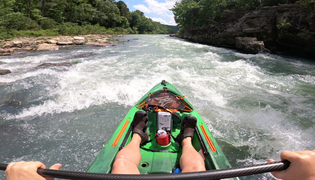

Turner Bend to Campbell Cemetery on the Mulberry River
Floating Turner Bend to Campbell Cemetery on the Mulberry River had been sitting on my adventure list for years. Having floated the Upper Mulberry stretches from Wolf Pen and High Bank to Turner’s many times, this middle section had been calling to me like an unfinished story. When I finally made the trip, it did not disappoint. I expected it to follow the pattern of many rivers – fast and splashy upstream, slowing to a gentler, lazier pace as it winds toward the lower end. Instead, this stretch threw my assumptions overboard. To my surprise, the current stayed quick and playful, delivering the same thrill as the upper Mulberry. With several exciting class II rapids and even more natural beauty, this was not the float I expected—it was far better. Quick Glance Distance: 10.1 mi...

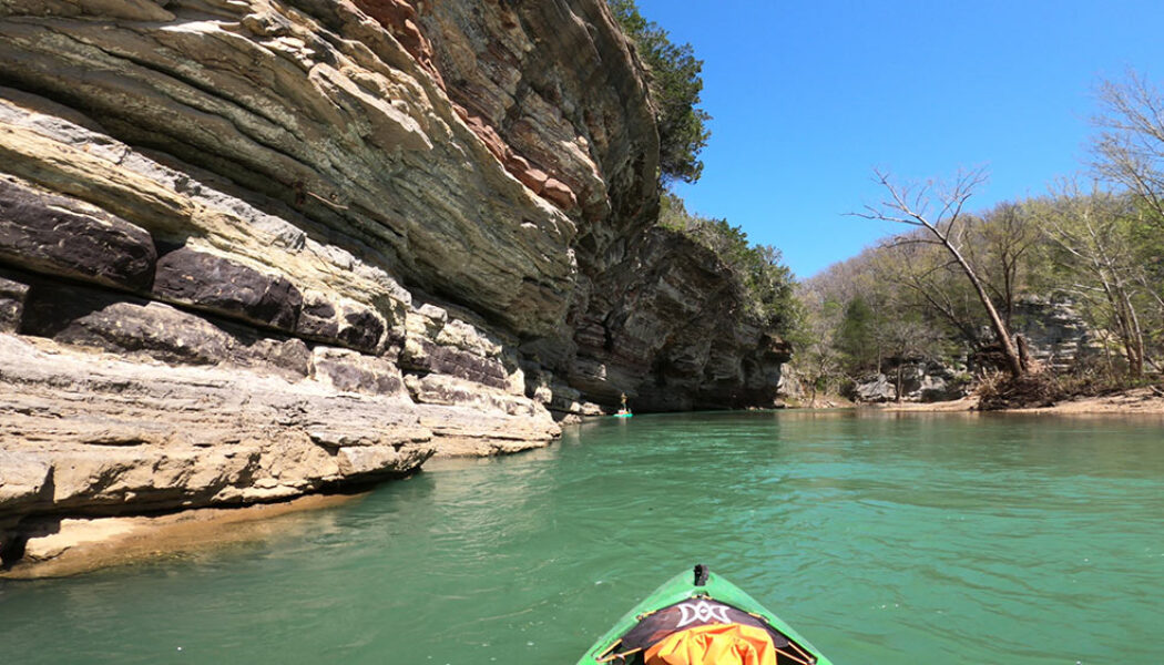
Floating Carver to Woolum on the Buffalo River
There’s something truly therapeutic about an overnight float trip on the Buffalo National River. The quiet stillness of the evening, and the crackle of a campfire under a canopy of stars. Sleeping to the sounds of water rushing through nearby shoals. A front row view of a towering bluff with the morning sun peeking over its ridge is one of the best ways to enjoy morning coffee. For those seeking a perfect blend of stunning scenery, manageable paddling, and ample camping opportunities, floating Carver to Woolum on the Buffalo River is an ideal choice. This journey offers a fantastic multi-day adventure that showcases the heart of America’s first national river. Floating Carver to Woolum on the Buffalo River is a classic overnight float through serene forests, rugged bluffs, and ...

Ozark Campground to Hasty on the Buffalo River
Floating from Ozark Campground to Hasty on the Buffalo National River offers a serene and scenic adventure through the heart of the Ozarks. This is a great option for paddlers that love the Pruitt to Hasty float but would like to add a couple more miles to it. Ozark Campground is two miles upstream from Pruitt Access. The seven mile float from Pruitt to Hasty is one of the more popular day trips on the Buffalo. Most – maybe all – of the local outfitters put paddlers on the river at Pruitt. I don’t know of any that provide float or shuttle service starting at Ozark Campground. I assume this is because Pruitt’s close proximity to Hwy 7 makes it much easier for outfitters to access than Ozark. But for anyone willing to self-shuttle their own boat and skip the line at P...
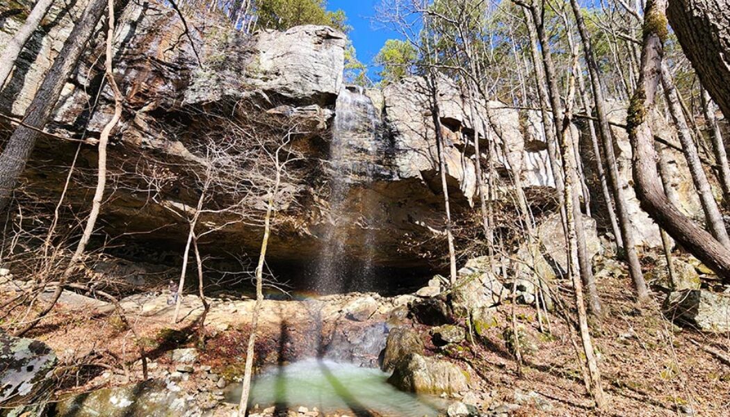

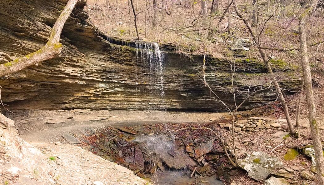
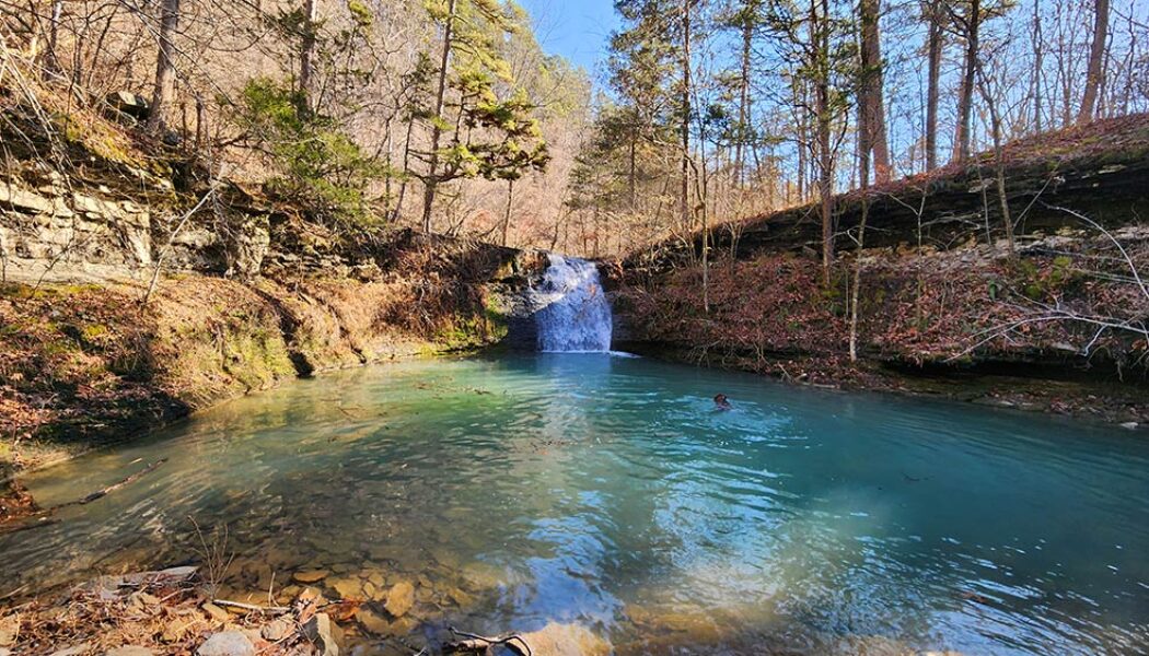
Hike to Grapevine Shelter and Blue Hole Cascades
While Grapevine Shelter might not be as widely recognized as some of Arkansas’ more famous natural landmarks, it is a captivating destination for adventurous hikers and waterfall lovers. Located in the Lost Corner area of the Southern Ozarks, this one is a little bit of a hidden gem. Like many other waterfalls in the Lost Corner area, Grapevine Shelter is not found in Tim Ernst’s waterfall book (second edition). But there are several falls close by that Tim included, such as Blue Hole Cascades and Green Grotto Falls. If you make the drive to see those, you might as well see Grapevine Shelter while you’re there. But only if you’re up for a challenge. Because the hike to Grapevine Shelter is not for everyone. Being mostly a bushwhack through the woods, this ...

Hike to Stave Mill Falls and Little Oak Falls
Years ago, I had the opportunity to go trail riding at Mack’s Pines on Hwy 7, north of Dover. And let me tell you, we had an absolute blast doing it. That was years before I had learned the lay of the land when it comes to waterfall hikes. So little did I know that day, that the waterfall we stopped to admire on our ride was actually Stave Mill Falls. And because we entered the trail riding area a good bit south of Mack’s Pines, I didn’t realize how close we were to the Moccasin Gap Recreation Area. Nor did I have any idea that it was only a short hike to Stave Mill Falls and Little Oak Falls. Fast forward several years and many dozen trips past Moccasin Gap on Hwy 7. This hike made my to-do list, but kept getting passed over for other hikes I wanted to check off my Tim E...
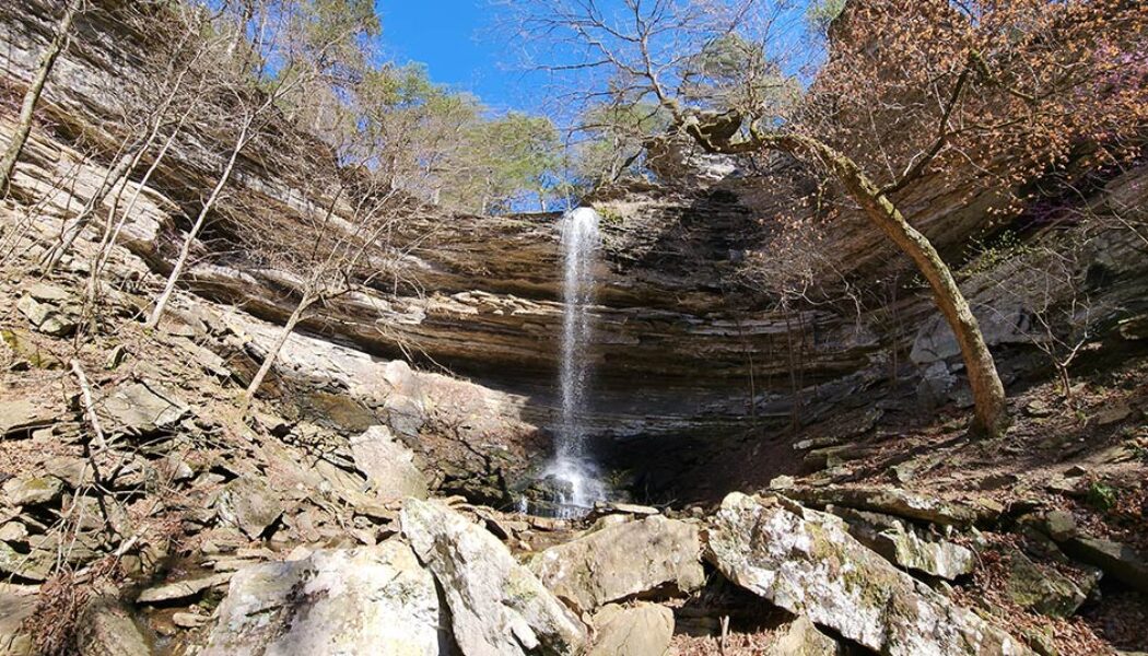

Hike to Devils Canyon Falls
On the rare occasion that I get much further west than the town of Ozark, it’s usually because I’m spending the night somewhere in Northwest Arkansas. It’s a little far for a day trip from Central Arkansas (my home), especially during the short Winter days when I do most of my hiking. So any time I travel to Northwest Arkansas, I try to check one of the waterfall hikes west of Ozark off my list. One of those hikes that had been on my list for a long time was the hike to Devils Canyon Falls. When I finally had an opportunity to peel off I-40 for a few hours to do it, this hike instantly made my favorites list. A short list that includes hikes like Thunder Canyon, Richland Creek, Winding Stairs, and Tea Kettle Falls, among others. The hike to Devils Canyon Falls is a somewh...

Hike to Hemmed in Hollow from the Compton Trailhead
In 2020, I made my first visit to Hemmed-in Hollow Falls. Admittedly, I took the short, easy route by making the quick hike from the Buffalo River while on a float trip. I knew about the popular hike to Hemmed in Hollow from the Compton Trailhead, and had heard it was pretty difficult. So after seeing the impressive sight of the falls crashing down into the hollow, I figured I could check this one off my list. (Seeing the falls is the whole point, right?). But after years of hiking other waterfalls, I felt like I needed this challenging hike on the blog. So I decided to return to Hemmed-in Hollow to do the hike from the top. Hemmed in Hollow Falls, located on the Buffalo National River, is 209 feet tall. That makes it the tallest waterfall in Arkansas. In fact, it’s the tallest water...
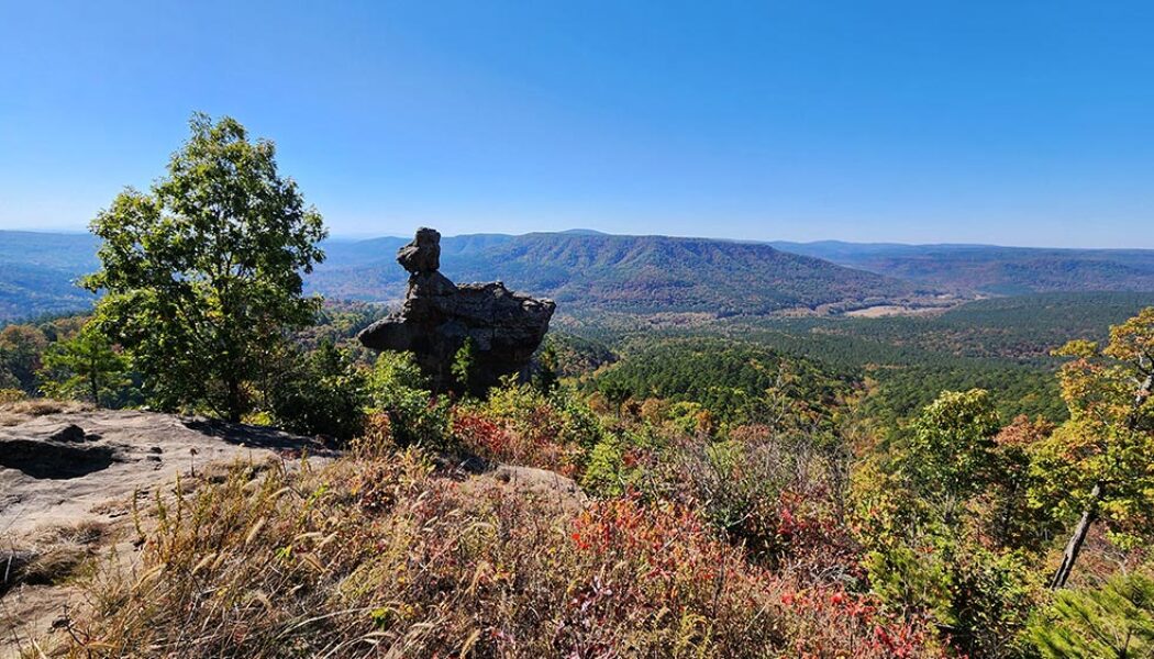

Hiking the Second Route to the Arkansas Sphinx
Some hikes are worth a re-visit. And a second viewing of that iconic monolith perched near the top of Hess Knob – known as the Arkansas Sphinx – is one such hike. There are two hiking routes you can take to the Sphinx. On my first trip there (read here), I opted for the shorter – but much steeper – route from parking area #1. While preparing for that hike, I read an article from the hiking blog of the late Rick Henry with info on a second route. Mr. Henry described the second route to the Arkansas Sphinx as longer, but less steep and strenuous than route #1. This route also hits the peak of Hess Knob with a magnificent vista view of the Sphinx and it’s scenic backdrop. So in my first Arkansas Sphinx article and video, I promised to come back to try the second ...
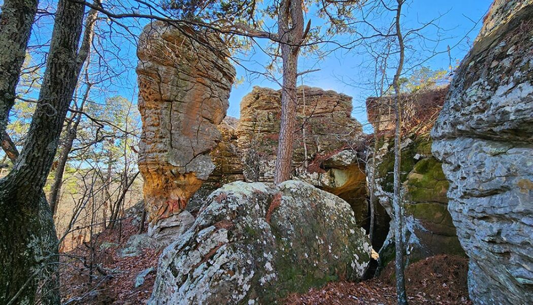

Hiking at Stem Rock Natural Area
In between float season and waterfall hiking season lies a season of dubious anticipation for many outdoor enthusiasts. When there’s not enough water to go floating, and waterfall hikes are non-existent. I call it the dry season. It’s one of the times of the year I often opt for mountain biking, even though I’m itching for a good hike. But there are some great non-waterfall day hikes out there to be had, like the one at Stem Rock Natural Area. Stem Rock is a cluster of rock formations, crevices, and small caves in Searcy County, AR, near the community of Oxley. If you enjoy hikes with cool rock formations, like Alum Cove or Kings Bluff, then you should enjoy this one. Although it’s not as big or impressive as those two, the short easy hike makes it definitely worth ...
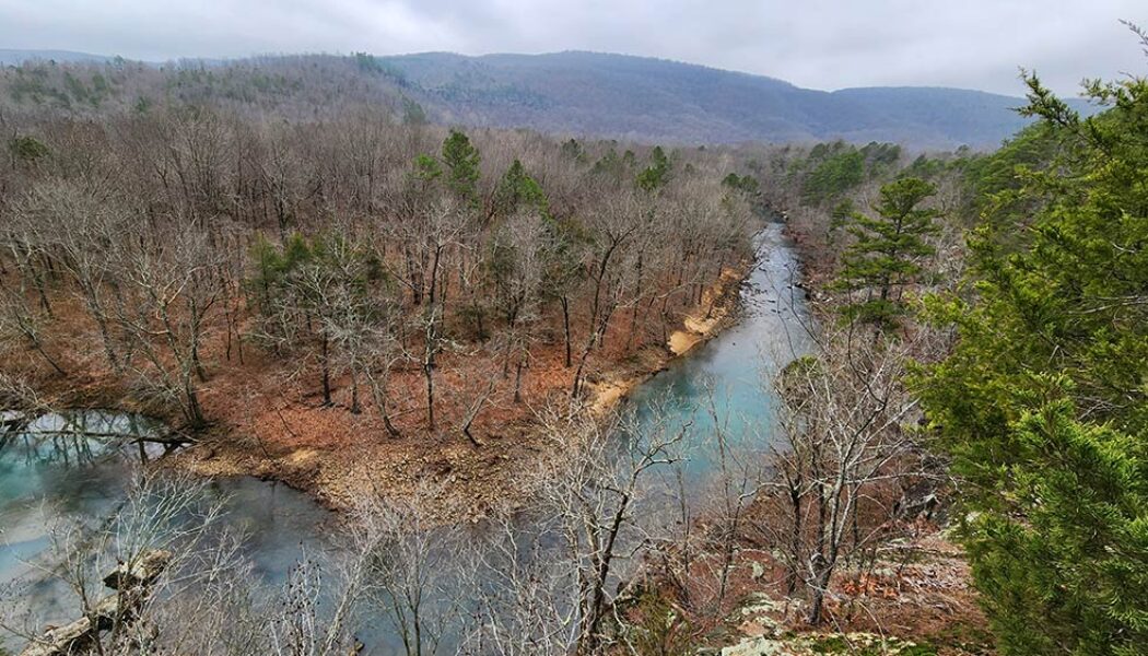

Exploring Bluffton Preserve – A Natural Gem in the Southern Ozarks
Tucked away in a beautiful valley just six miles north of Clinton in the southern Ozarks lies the Bluffton Preserve Nature Area. This is another natural area managed by the Nature Conservancy. Through the help of generous donors, the Nature Conservancy is the same group responsible for bringing us other wonderful recreational areas like Rattlesnake Ridge and Blue Mountain. While exploring Bluffton Preserve, I immediately realized this place is an outdoors treasure chest. There are professionally built trails for mountain biking, hiking, and backpack camping. Four miles of the Archey Fork Little Red River flows right through the area, with an access point for launching canoes and kayaks. This picturesque stream provides swimming holes, fishing, and a beautiful backdrop for hiking and observ...
